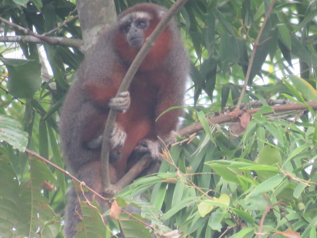
In our two last post we talked about our adventures and observations in the field, however doing science also means more work after the fun part, so today we are talking about some of the work we do after every fieldtrip. Clarification: for me fun part is always fieldwork… As some of you had read, we are doing a revision of ornate titi monkeys distribution limits, so after each fieldtrip, we need to do several things to make sense to all our data and to better understand where this endemic species is really found. This project includes a lot of mapping. We need to download all GPS information we collected in the field. We also need to review each point and verify that is correctly labeled for each observation. We also review each track and calculate total distance of each sampling for reporting. Additionally, as we are reviewing the whole distribution of ornate titi monkey, we also need to verify what areas inside its distribution area are still cover by forest. Therefore, we need to review and process several satellite images and use several layers or maps with different land covers. These layers or maps of different land covers need to be verified, which means we need to verify that each land cover is correctly placed, we used two methods to make this verification. First and every time that its possible we verify land covers on the ground by verifying our maps with direct observations in the real places. When access to those areas is difficult, we analyze several satellite images from the same area from different months to corroborate an specific area is covered by forest or any other specific land use such as palm oil plantation or rice plot, for example.After that we put all our observation points on a map, which includes all forest areas identified as well as all our field observations and observations from other researchers and verified records from other observers. Part of this work requires that we collect information from public databases, citizen science and review published and unpublished information. After all this we calculate current distribution of this endemic species using GIS tools. So after a lot of fieldwork we also spend a lot of time in front of our computers reviewing and processing information, and by this we mean we continue having fun by looking at maps and satellite images to complement what we observe in the field. Hopefully all this new information will help us to better conserve this incredible endemic species of Colombian Llanos, especially from Meta department.If you want to support our activities, please visit https://fineartamerica.com/art/xyomara+carretero or get in contact with us at xcarretero@gmail.com if you want to collaborate, donate or volunteer in our activities. You can also support our activities by buying our ornate titi monkeys stuff dolls https://www.instagram.com/p/Ctm_sEORvk8/?igshid=MzRlODBiNWFlZA== and our new journals in Amazon https://www.amazon.com/X-Carretero/dp/B0CWD1DBJM/ref=mp_s_a_1_1?© Copyright Disclaimer. All pictures used on this web page are protected with copyrights to Xyomara Carretero-Pinzón. Picture in this post was taken by Francisco Gomez. If you want to use any of these pictures, please leave a message on the website or contact xcarretero@gmail.com
